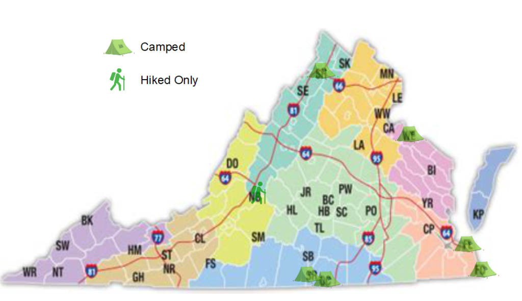
I’m starting a series to track my exploration of Virginia State Parks. Posts will be back-dated to when I actually went to the park, and I’ll add the respective photo album from the hikes, etc. I’ll also be keeping the image below up to date as possible!

- Bear Creek Lake (BC)
- Belle Isle (BI)
- Breaks Interstate (BK) *
- Caledon (CA)
- Chippokes Plantation (CP)
- Claytor Lake (CL)
- Douthat (DO)
- Fairy Stone (FS)
- False Cape (FC)
- First Landing (FL)
- Grayson Highlands (GH)
- High Bridge Trail (HB)
- Holliday Lake (HL)
- Hungry Mother (HM)
- James River (JR)
- Kiptopeke (KP)
- Lake Anna (LA)
- Leesylvania (LE)
- Mason Neck (MN)
- Natural Bridge (NB)
- Natural Tunnel (NT)
- New River Trail (NR)
- Occoneechee (OC)
- Pocahontas (PO)
- Powhatan (PW)
- Sailor’s Creek Battlefield Historic (SC)
- Seven Bends (SE) **
- Shenandoah River (SH)
- Shot Tower (ST)
- Sky Meadows (SK)
- Smith Mountain Lake (SM)
- Southwest Virginia Museum Historical (SW)
- Staunton River (SR)
- Staunton River Battlefield (SB)
- Twin Lakes (TL)
- Westmoreland (WE)
- Widewater (WW)
- Wilderness Road (WR)
- York River (YR)